-40%
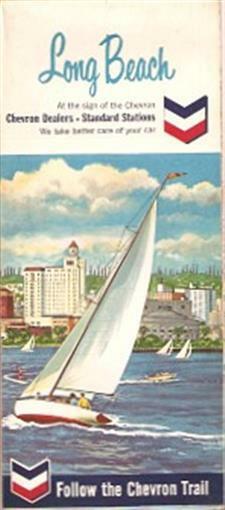
1965 CHEVRON Sailboat Road Map LONG BEACH California
$ 4.74
- Description
- Size Guide
Description
1965 CHEVRON Sailboat Road Map LONG BEACH CaliforniaHandsome fold-out street plan of Long Beach and the metropolitan area south of Los Angeles, printed more than 45 years ago.
This map opens to 18" x 34" and has great detail on old road alignments, with cartography by H.M. Gousha. The cover artwork shows a sailboat skimming along the waters of San Pedro Bay.
The coverage area includes Manhattan Beach, Compton, Lynwood, Seal Beach, El Segundo, Torrance, Signal Hill, Lomita, Palos Verdes Estates, Redondo Beach, and more.
The map was distributed by the Standard Oil Company of California in 1965 and is dated in the legend.
Condition:
It is in very good condition, bright and crisp, with a tiny dab of white-out on the cover and no rips or tears. We are pleased to offer it with
our unconditional, money-back guarantee.
Powered by SixBit's eCommerce Solution
