-40%
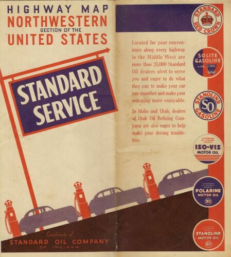
1940 STANDARD OIL Road Map NORTHWEST US Washington Oregon Idaho Wyoming Montana
$ 5.48
- Description
- Size Guide
Description
1940 STANDARD OIL Road Map NORTHWEST US Washington Oregon Idaho Wyoming MontanaHandsome fold-out Standard Oil Company road map of the northwestern United States, printed more than 73 years ago.
This map opens to 20" x 27" and has great detail on old highway alignments, including U.S. Routes 2 and 10, with cartography by Rand McNally.
The coverage area includes Washington, Oregon, Idaho, Wyoming, Montana, and parts of Colorado, Utah, Nevada, and California. On the reverse side there is a mileage chart and a transcontinental U.S. highway map.
The map was distributed by the Standard Oil Company of Indiana in 1940, and it is dated by the code number in the lower margin: N-1. The back panel includes ads for various Standard products, including Polarine motor oil and Solite gasoline.
Condition:
This map is in very good, lightly used condition, with
no
marks, rips, or tears. We are pleased to offer it with
our unconditional, money-back guarantee.
Powered by SixBit's eCommerce Solution
